
LiDAR Survey & Mapping Solutions
What Is LiDAR?
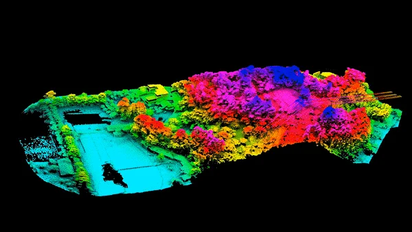
LiDAR, short for Light Detection and Ranging, is a remote sensing technology that uses laser pulses to measure distances with exceptional precision. By emitting rapid pulses of light and measuring the time it takes for them to bounce back from surfaces, LiDAR creates highly detailed 3D maps of terrain, vegetation, infrastructure, and built environments.
Unlike traditional surveying methods, LiDAR can collect millions of data points in a matter of seconds—even in areas that are hard to reach or heavily vegetated. This makes it ideal for a wide range of industries, including aviation, construction, urban planning, environmental studies, and infrastructure development.
Our LiDAR Services
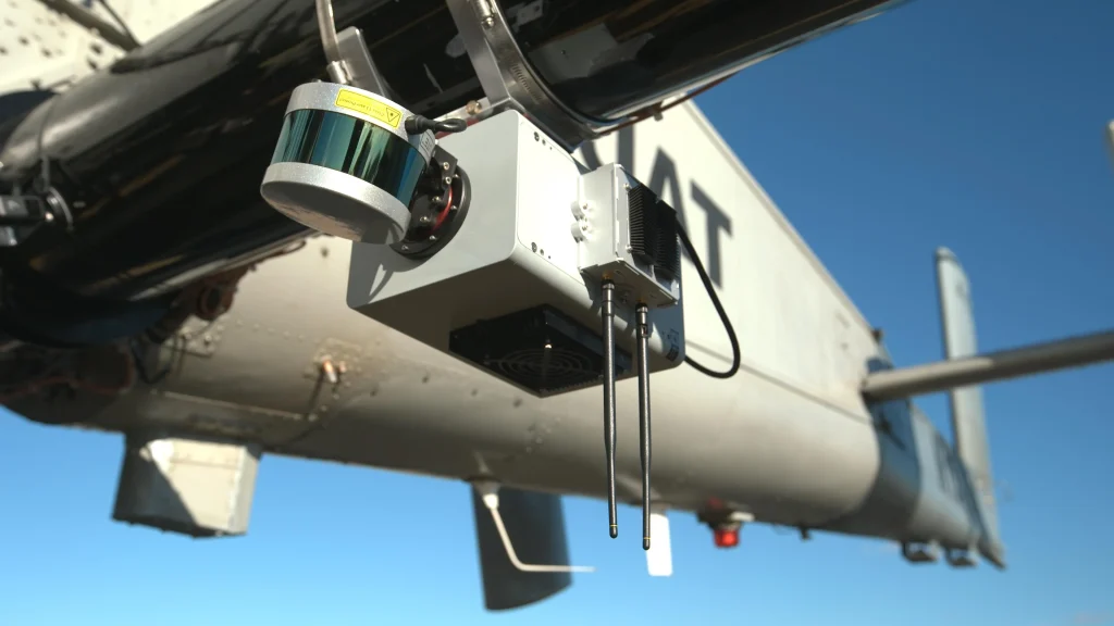
At AES Lanka, we provide advanced LiDAR survey and mapping solutions tailored to the demanding standards of aviation and engineering sectors. Whether mounted on drones, aircraft, or vehicles, our LiDAR systems deliver fast, accurate, and detailed spatial data that supports efficient decision-making and regulatory compliance.
🔍 What We Offer
-
Airborne LiDAR Surveys
High-altitude scanning for large-scale mapping and analysis. -
Drone-based LiDAR
Flexible, low-altitude data capture for high-detail surveys in tight or sensitive areas. -
Digital Terrain & Surface Models (DTM/DSM)
Create highly accurate 3D representations of ground and surface features. -
Obstacle Limitation Surface (OLS) Mapping
Ensure compliance with ICAO and local CAA standards for obstacle-free zones around airports. -
Topographic & Land Use Mapping
Generate real-time, georeferenced models for development, construction, and planning. -
Vegetation & Canopy Analysis
Measure tree heights, canopy density, and ground cover even in dense forested areas.
Why Choose AES Lanka for LiDAR?
High Precision: Centimeter-level accuracy for all datasets.
Speed: Rapid data collection and delivery with minimal disruption to operations.
Versatility: Solutions tailored for aviation, civil engineering, energy, and environmental sectors.
Expert Team: Operated by professionals trained in both LiDAR tech and aviation-grade data requirements.
Seamless Integration: Output formats compatible with GIS, CAD, BIM, and planning systems.
Applications Across Sectors
Airport Runway & Airfield Surveys
Infrastructure Development
Disaster Risk Management & Flood Modeling
Highway and Road Corridor Mapping
Urban Development & Smart Cities
Mining & Resource Exploration